


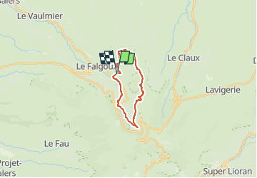

18,8 km | 28 km-effort


Utilisateur


Application GPS de randonnée GRATUITE
 SityTrail
IGN / Instituts géographiques
SityTrail World
Le monde est à vous
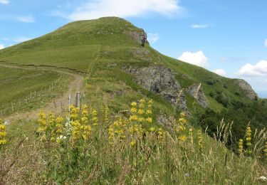
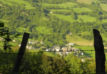
Randonnée Marche de 17,3 km à découvrir à Auvergne-Rhône-Alpes, Cantal, Le Falgoux. Cette randonnée est proposée par Jean Yves Erard.
départ de la Franconèche, montée au Luchard ( 500 m de dénivelé), plateau de landes magnifique, un peu de Gr400 et retour par le chemin des Italiens

Marche
Autre activité
A pied

A pied

A pied
A pied
A pied
A pied

Marche